Exhibition on the Manhattan Grid
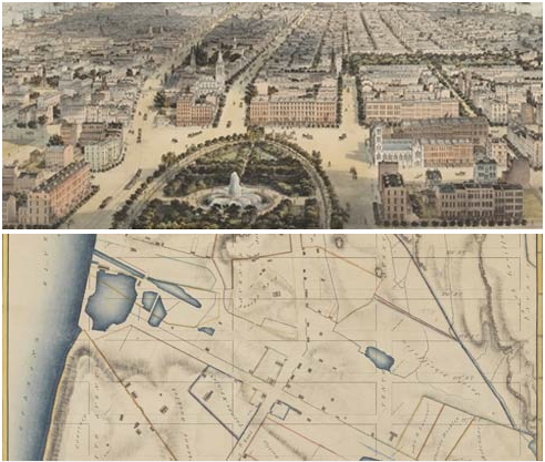
The exhibition, which is on view until April 15, celebrates the 200th anniversary of the Commissioners’ Plan of 1811, the foundational document that established Manhattan’s famous street grid. Featuring an original hand-drawn map of New York’s planned streets and avenues prepared by the Commission in 1811, as well as other rare historic maps, photographs and prints of the evolution of the city’s streets, and original manuscripts and publications that document the city’s physical growth, the exhibition examines the grid’s initial design, implementation, and evolution. The Greatest Grid traces the enduring influence of the 1811 plan as the grid has become a defining feature of the city, shaping its institutions and public life.
http://www.mcny.org/exhibitions/current/The-Greatest-Grid.html